On August of 2009 the first drilling campaign of the Sperling prospect, located to the north of El Salado in Chile, was concluded with promising results for the discovery of a large IOCG deposit, with drillings with large intersections of high grade iron and some intersections with chalcopyrite which indicates promising vectors to find mineralization of economical interest, both for copper and iron.
The Sperling prospect is located 17 kilometers to the north of the small town of El Salado, and at 40 kilometers from the Barquitos Port in the city of Chañaral, which is held by 10 mining tenements with a total of 3,200 hectares.
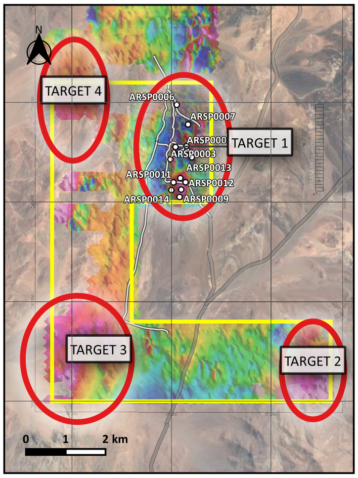
The prospect is located within the Chilean Iron Belt (CIB) and is crossed by the Atacama Fault System which is known to hold several projects for the exploration and production of copper, iron, and other metals. The first ground magnetic survey performed by MAPPING in 2007 showed five targets for exploration which are related to high magnetic anomalies. Target 1, was selected for further exploration since, in the past, this Target was exploited for iron ore, and it also showed some copper outcrops in some areas.
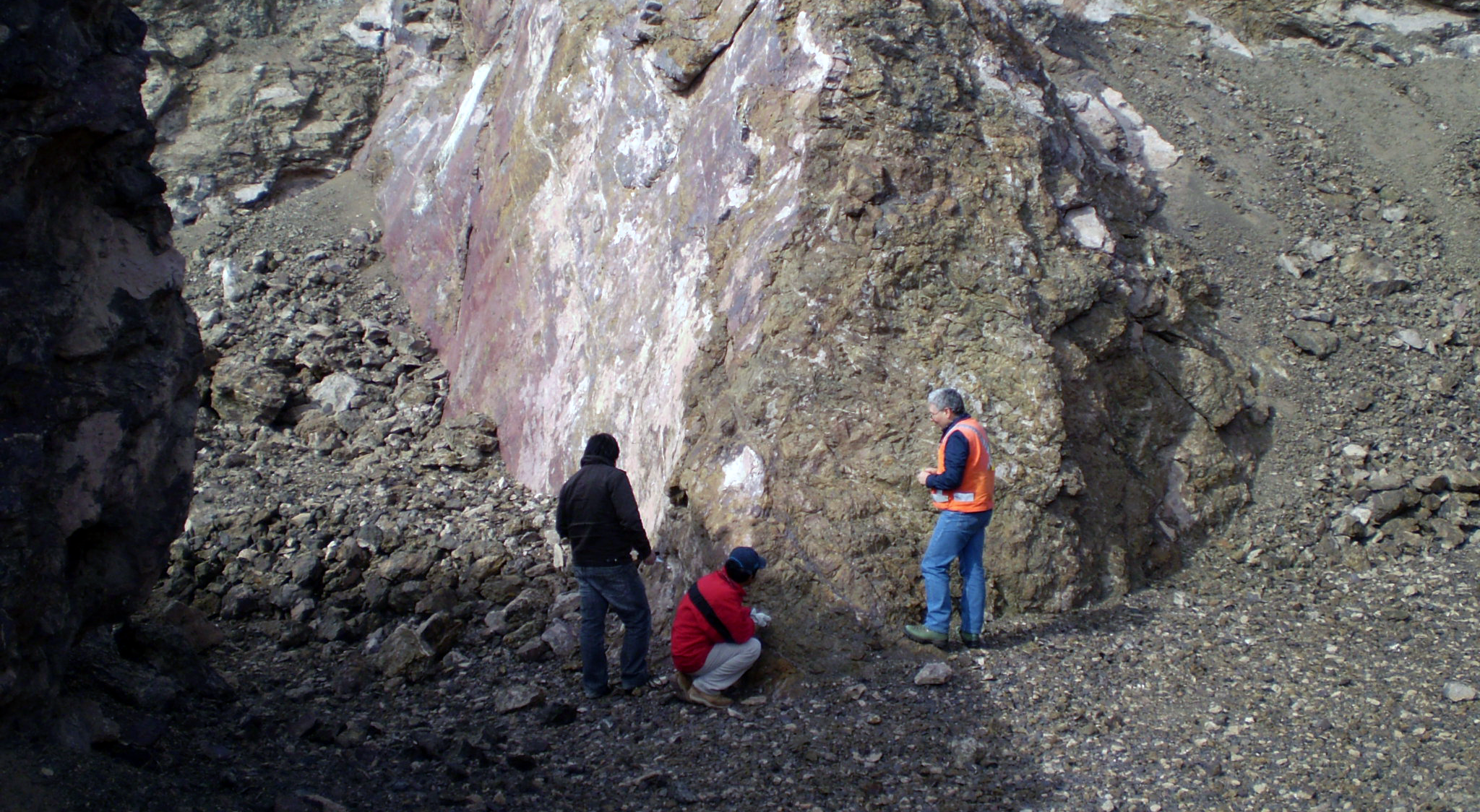
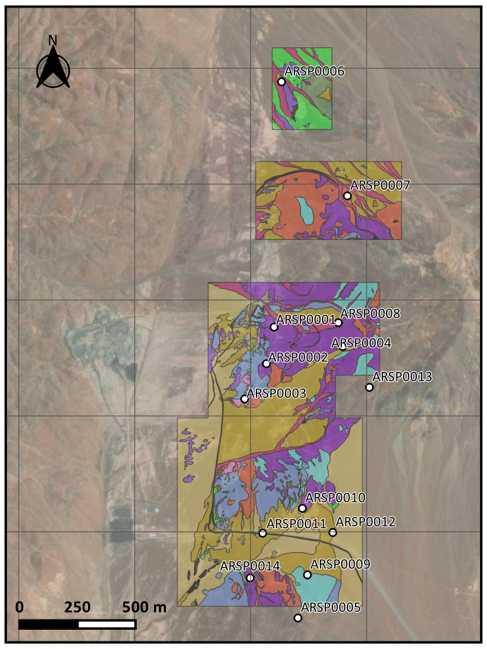
Following a detailed ground magnetic survey and a gravimetric survey performed by MAPPING, and a detailed geological mapping on Target 1 performed by Goldberg, both in 2009, several areas that showed magnetic and gravimetric anomalies were recognized as mineralized. High magnetic anomalies showed iron mineralization on the surface, as well as old mining pits which showed a strict correlation to high magnetic susceptibilities. On the other hand, low magnetic susceptibilities areas were found highly altered on the surface, as also with some mineralization of copper oxides. The alteration was mainly seen as iron oxides associated with feldspar and mica, such as chlorite, sericite, and biotite, iron mineralization was mainly seen as magnetite, and in highly altered areas, were seen predominantly as hematite.
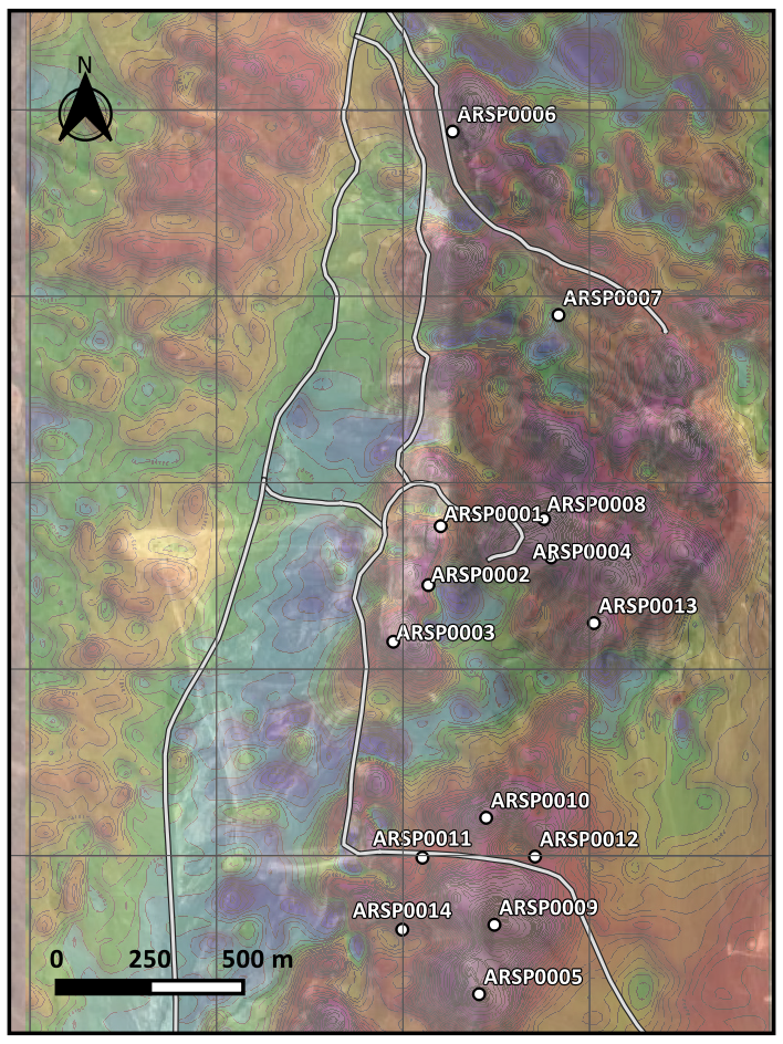
The areas that showed more prospectivity were selected for the drilling site locations, 14 boreholes were drilled by reverse circulation drilling which varied in length from 190 to 247 meters totaling 2,433 meters, and dust and rocks samples were extracted every half meter with a total of 1,622 samples. These samples were sent for analysis to the ALS laboratory for ICP-MS analysis.
The results of the drilling campaign showed several intersections of high-grade iron, with grades going from 10% to over 50% of total iron, and large intersects in the drilling ARSP0001, ARSP0002, and ARSP0003 forming a corridor of over 400 meters of high-grade iron mostly in the form of magnetite. There were also intersects of copper mineralization in the form of sulfur, being chalcopyrite the main copper mineral, grades were sub-economical, but there is strong evidence for an IOCG deposit, with high-grade iron and low-grade copper, and higher grades in the hydrothermal breccias, which were not drilled in this campaign.
To estimate the geological potential of iron resources, a model of continuity was developed for the iron mineralization, by the polygon method, these polygons were extruded vertically by 100 meters, following the hypothetical emplacement of the iron ore bodies. The resulting potential is 90 million tonnes at an average grade of 20% of total iron.