At request of Mr. Stephen Prior, Managing Director of Admiralty Resources (ADY:ASX), a review of the geological information of the approximately 2,500 hectares mining tenements owned by ADY. The mining tenements are located directly to the west of the Panamericana Route 5, just a few km south of the city of Vallenar, so its access is extremely easy and expeditious. The property extends for about 7 km to the south.
For this purpose, Goldberg Resources received a variety of scattered information and large texts along with figures and plan maps, as is the case of the gravimetric method implemented in the middle and southern part of the mining property. To proceed with the general analysis, it was necessary to process and georeference figures and basic plans.
The magnetometry and the gravimetry results show a NE-SW orientation strip of anomaly in the southern part of the tenement. The above is also confirmed with the orientationof old small iron exploitations carried out in the past . The analysis of geophysical methods provides good results at a global level and is focused on detecting exploration targets in the entire mining property.
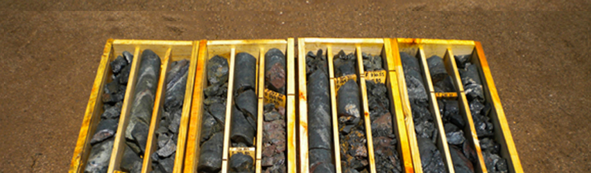
The exploration conducted at the Target Mariposa of Admiralty Minerals started with a reverse circulation drilling campaign. The information obtained from the 1,364 m drilling in the Mariposa anomaly is considered as key information, of great importance to establish the guidelines of future exploration for Mariposa, as well as for other exploration targets.
To the south of Mariposa there is the target Chulula, both Mariposa and Chulula are, according to geophysical information, separated by a larger structure, or by a zone of intense hydrothermal alteration. However, the gravimetric method shows high continuous densities, and in fact there is a sector of continuity between “Mariposa” and “Chulula” maybe in the form of hematite or another type of mineralization, such as copper. The exploration of Mariposa Sur (Chulula) could considerably increase the iron mineral resource of this Target. Because of this, it is vitally important to carry out an exploration work in that area.
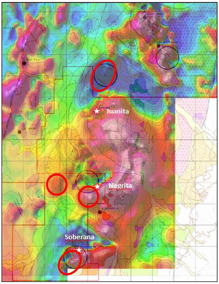 In the analysis of the geophysical information, negative anomalies stand out in a series of locations within the extensive mining property. These should largely correspond to sectors of medium to intense hydrothermal alteration, which at the time should be recognized as potential exploration potentials for copper resources in an association with iron oxides and gold.
According to the foregoing, Goldberg recommended the following activities to Admiralty: Develop a high resolution magnetometry for the “Mariposa – Chulula” and “Soberana – La Negra” Target with profiles no more than 40 meters between the measurement line, eventually develop gravimetry with measurement points closer to each other, complement the exploration of the aforementioned Targets, with a geological reconnaissance of more detail, and carry out an inventory of possible future targets for both iron ore and Cu ore, following a of mineralization type IOCG (Iron-Oxid-Copper-Gold).
If the antecedents of the previous activities are framed within the expected information ranges, it was recommended to carry out a first drilling campaign in the mentioned Targets, using only reverse air drillings in a first stage. The campaign would have the goal of discovering the mineral resource, so only in a second phase, the campaign should add some diamond drilling.